
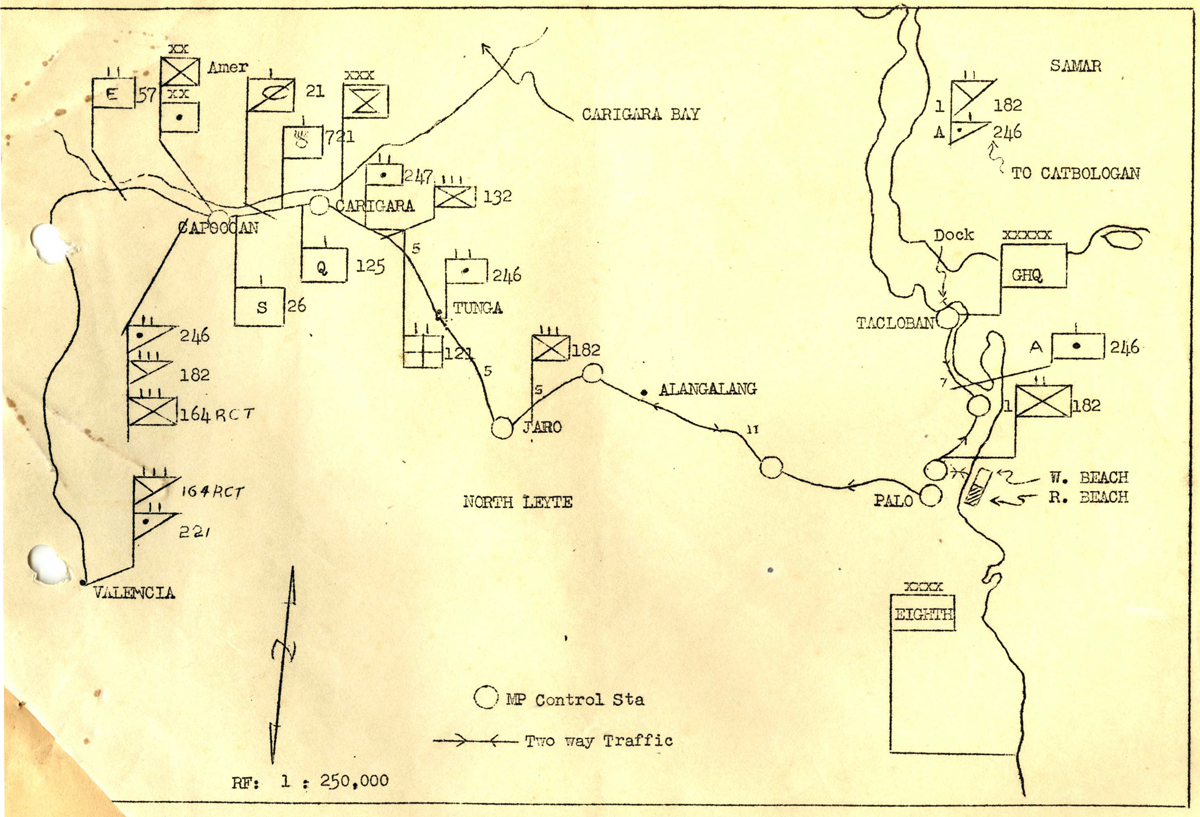
On 21 January 1945, Americal Division units began arriving on the island of Leyte, in the Philippine Islands (see Google Map here). For the previous 3 months, a furious battle had been raging on land, sea, and air, as MacArthur’s return to the Philippines was underway. The campaign to retake the island chain began in Leyte, on the east coast. By January, Allied attention was focused elsewhere, on the Allied thrust towards Manila, on the island of Luzon. According to intelligence reports, Leyte was relatively secure, and the units of the Americal were needed only to “mop up” the few remaining Japanese forces on the island. The map in Photo #1 shows landing and movement orders for the Americal Division on the island. They landed on the eastern coast, near Tacloban, and then moved towards the west coast, into the Ormoc Valley.
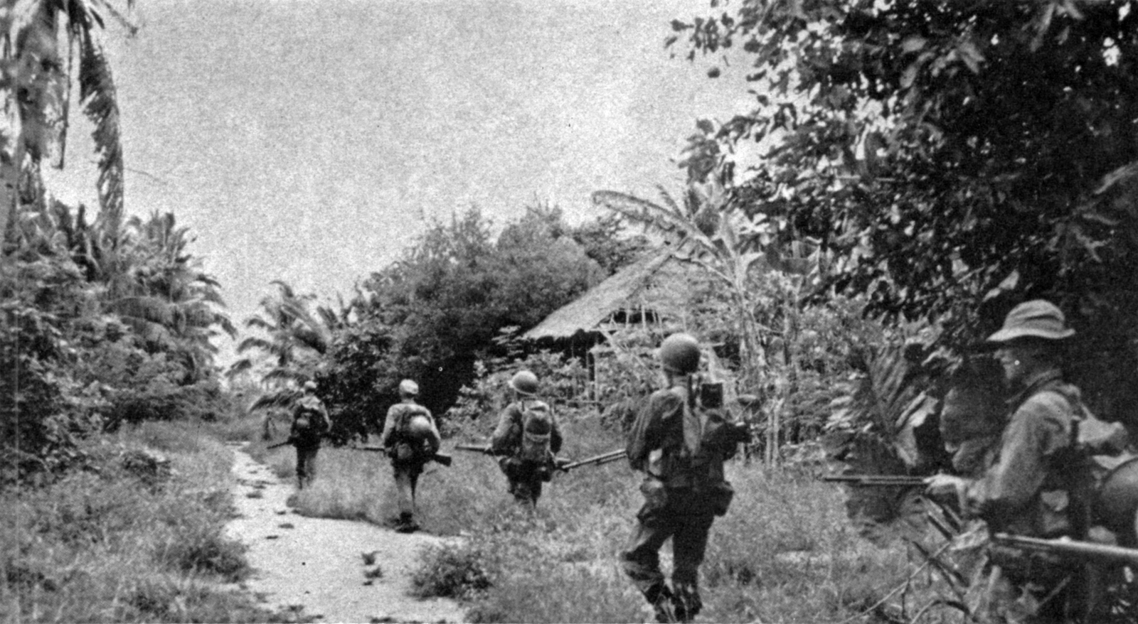
The Japanese had initially reinforced their garrison on Leyte when Allied forces landed, but by January they were in full retreat. Units were concentrated in the Ormoc Valley, with many attempting to flee by water to neighboring island such as Cebu. By February, Company G and the entire Americal Division were engaged in large scale operations, and meeting with stiff resistance. The veterans of Guadalcanal and Bougainville had to adjust to combat operations in a different environment. Where those islands in the Solomons were covered with nearly impassible jungle, Leyte was instead dotted with soaring ridges, and open fields. There were also a larger human presence, in the form of small villages and towns. In photo #2, units of the Americal on patrol pass a small hut.
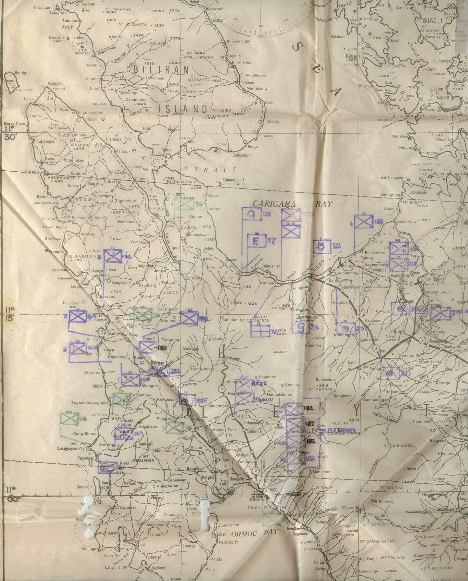
By the end of February, Americal units were dispersed all over the western peninsula of Leyte, hunting Japanese units. They often acted on intelligence reports from locals, which more often than not proved to be exaggerations. The map in Photo #3 shows Americal positions on Leyte around 24 February 1945. On March 4-5, the 182nd encountered particularly stiff resistance in the hills of Leyte. This S-2 Report indicates that Company G claimed 55 Japanese soldiers killed during the fighting. They also reported that the Japanese were using American ammunition. The 182nd Infantry reported 593 Japanese killed since the end of January as of this report.
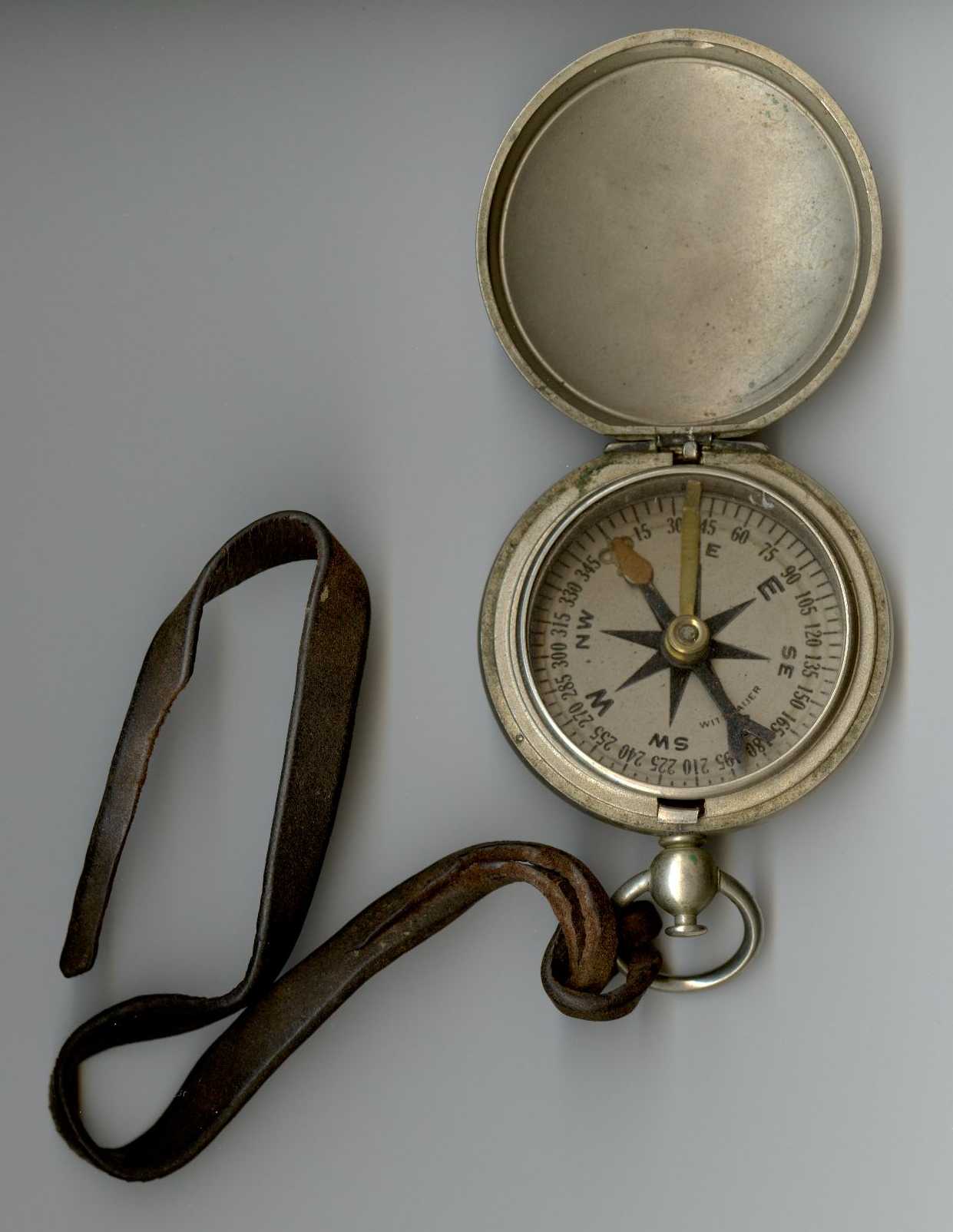
During the fighting March 5, Ken Lachmann of Company G was asked to perform a dangerous solo mission, laying communication wire and scouting a possible route of retreat. Before departing, the company’s First Sergeant, Ed Monahan, asked if Lachmann had a compass and pocket knife for the mission. Lachmann did not, so Monahan lent him his own compass and knife. In the pitched battle that soon flared up, Lachmann was shot through the arm, and evacuated. He spoke briefly with Monahan before being evacuated, but did not remember to return the compass and knife. The two men never saw each other again or spoke after the war. But Lachmann carefully held on to the two borrowed items, and returned them to the Monahan family in 2004 (Photo #4).
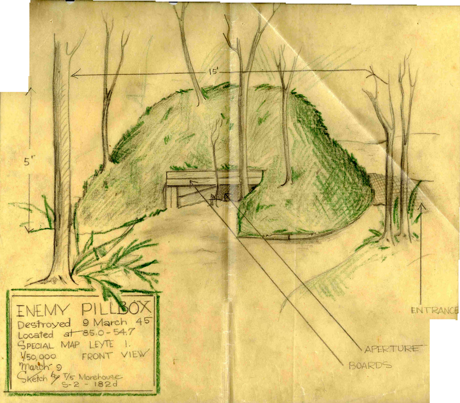
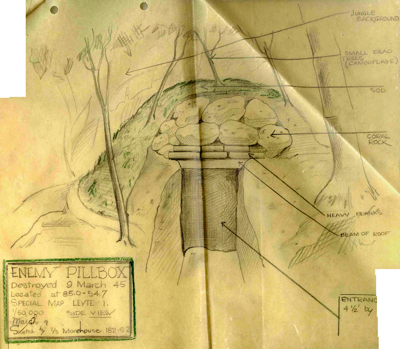
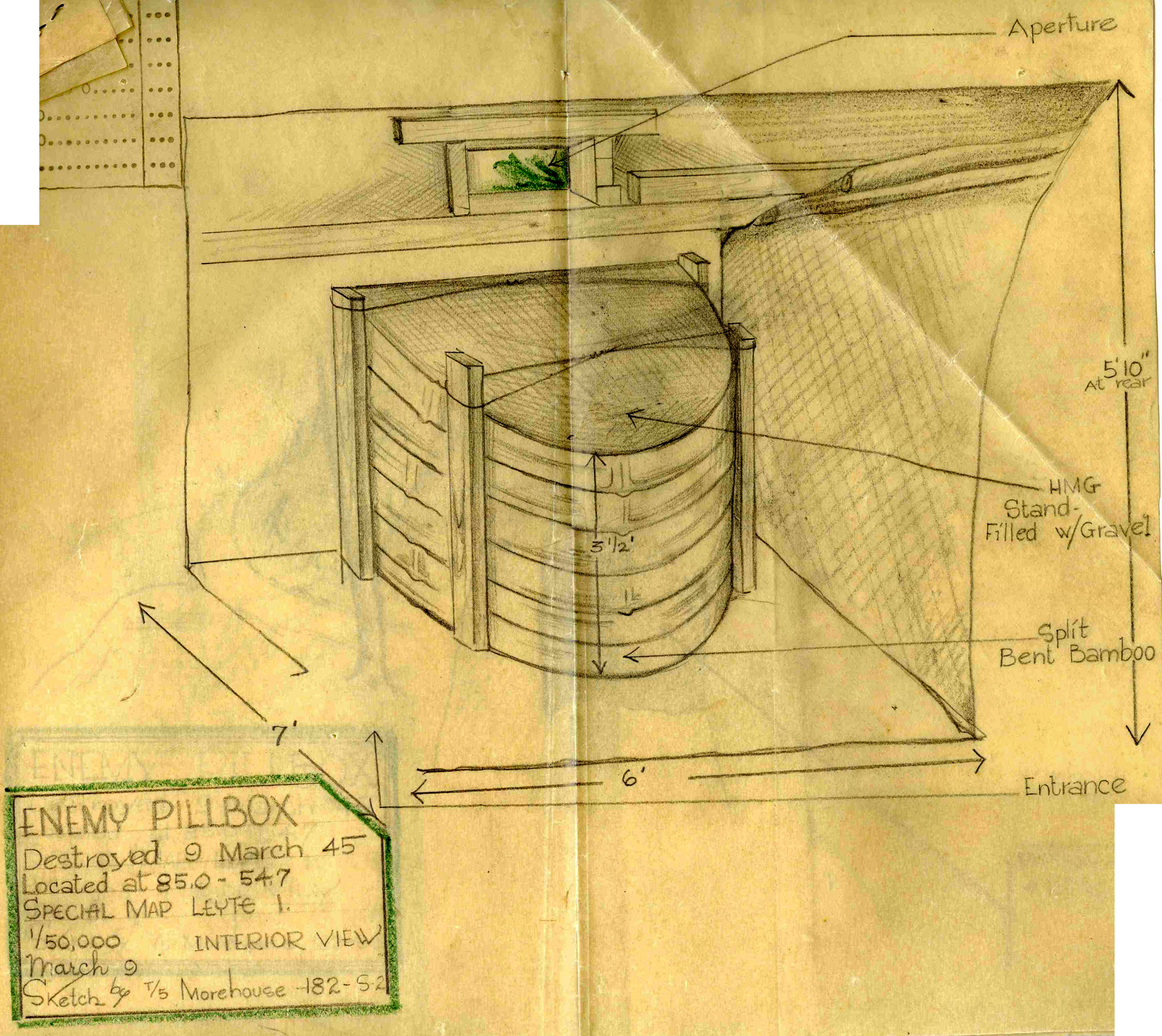
Americal operations encountered numerous fixed Japanese defensive positions on Leyte. An artist’s sketch of a Japanese pillbox, drawn by a soldier of the 182nd Infantry, shows the front (Photo #5), side (Photo #6), and inside (Photo #7) of this defensive position. The pillbox was destroyed 9 March 1945, in the final week of Americal operations on Leyte. The division had spent less than 2 months on the island, but claimed to have killed 3500 Japanese soldiers. Many involved, including Eighth Army commanding officer General Robert Eichelberger, resented the use of the term “mop-up” for this bloody operation.
With the completion of combat operations on Leyte, the men of the Americal began training for something new, a combat operation they had yet to attempt during World War II: amphibious assault of an enemy controlled beach.
Next Chapter: Cebu: Hostile Beach