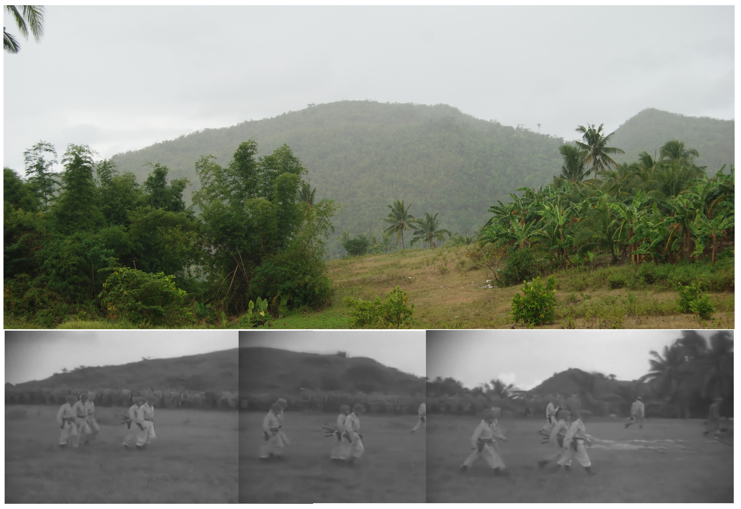
Comparison of 1945 footage of the Japanese surrender on Cebu with background terrain taken in 2015. (Source: Internet Archive/film, Dave Colamaria/Photo).
I’ve been watching a film of the August 1945 surrender of Japanese forces on the island of Cebu in the Philippines (you can watch it here). There is just a bit under 10 minutes of footage posted online. I noticed that there are a number of wide shots, showing the background. This got me thinking about where precisely the ceremony took place. In March 2015 I traveled to Cebu to visit key World War II battle sites, and follow the path of the Americal Division in liberating the island from Japanese occupation. Our trip ended in the far north of the island, near Ilihan, where a new monument was dedicated at the surrender site (read the story here). The land for the monument was generously donated by Mrs. Eusebia Ycot, who was present at the surrender ceremony 70 years earlier.
A comparison to the 1945 film footage shows that the terrain has changed a bit. The tree cover seems a bit denser in 2015 than in 1945, though this may just be a function of where I was standing. Many of the shots in the middle portion of the film show a wide open vista of rolling hills – a view I don’t recall seeing during our trip. One of the other struggles is that this is not a high resolution film transfer, so the footage is a bit blurry. It is difficult to pick out details.
The camera pans repeatedly to follow Japanese and American soldiers moving in the field, giving a good view of the terrain. I studied the film, looking for anything that I could use to compare to photos that I took in 2015. I immediately focused on the footage beginning at 3:15, just following the formal surrender. In the background, two small hills can be seen. There appears to be some similarity to two small hills in a photo I took in 2015. It is not an exact match, as I believe that the perspective is a bit off. From what I can surmise, I believe that the 1945 film camera footage was taken from a vantage point slightly different than mine. I think if I were to have walked forward and to the left a few hundred yards, I may have been on the exact spot of the surrender.The hills in my photograph were to the north, and we were told that the Japanese troops marched down from these hills to the surrender site. Thus, the fact that Japanese troops are standing with their backs to the hills is another small clue. For a side-by-side comparison, I stitched three frames of the 1945 film footage together and lined it up next to my 2015 photo, which can be seen in Photo 1.
There are two other noticeable terrain features in the film footage. The footage at various times shows a tree lined road in the background, with a gully between the road and the foreground. I don’t recall a gully that deep, but it was a hectic day when we visited in March 2015. I found nothing else distinctive in the footage, in part due to the poor resolution of the transfer.
Based on where I was standing when I took that photo in relation to the new monument (the monument would be off to the right of the photo, maybe 100 yards away), I suspect that the surrender most likely took place a few hundred yards off the main road, perhaps almost directly behind the location of the monument. Unfortunately, unless I have a chance to travel to the Philippines again the future, I can’t be much more accurate than that.
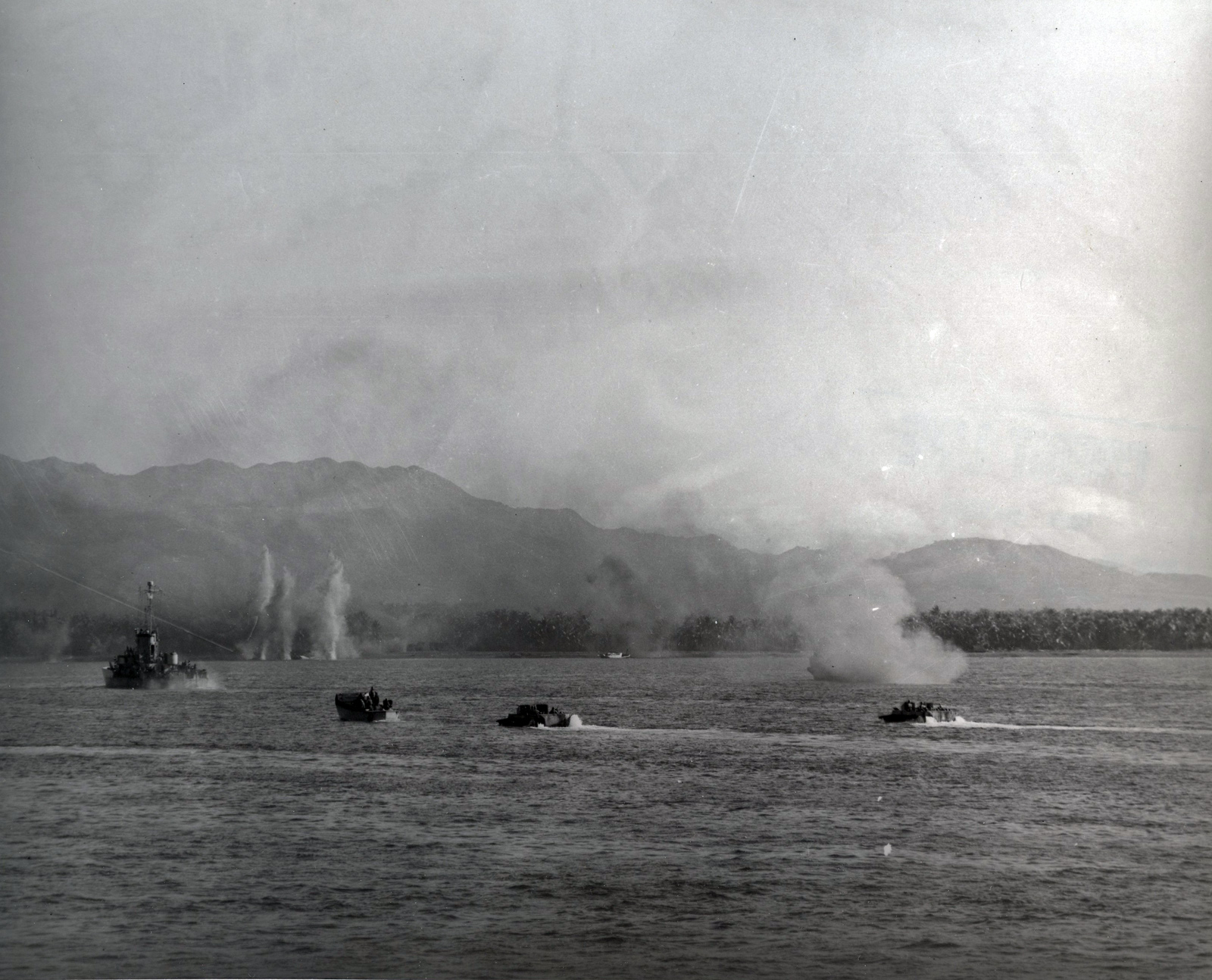
The imposing peaks of Babag Ridge can be seen in the distance of this photo taken during the invasion of Cebu, 26 March 1945. Source: Naval History and Heritage Command, 80-G-259246.
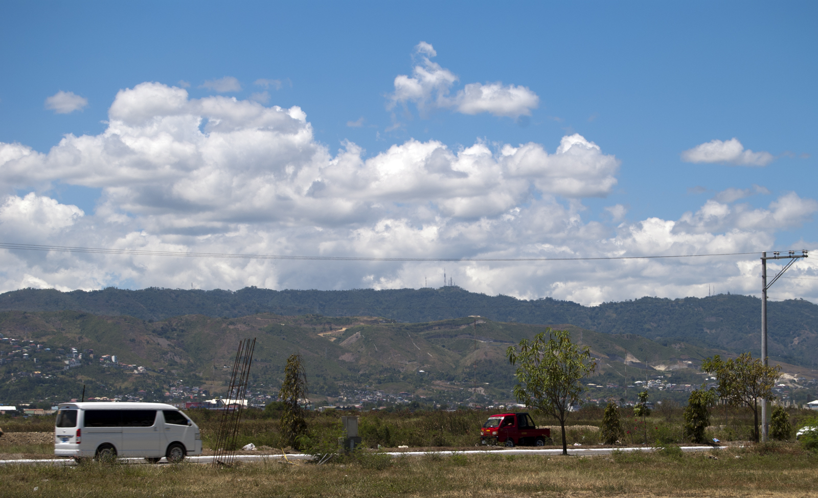
Looking west towards Babag Ridge from the coast of Cebu, March 2015. Source: Dave Colamaria.
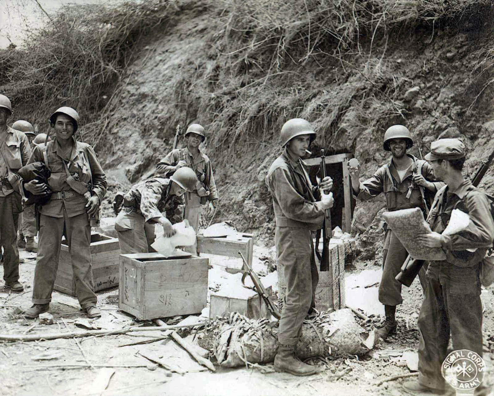
The Japanese on Cebu retreated to caves and fixed positions in the hills. Here, soldiers of the 182nd Infantry rifle through Japanese materials left behind in a cave on Babag Ridge. Source: National Archives.
Members of the Americal Division Veterans Association tour a Japanese tunnel complex on Cebu. Source: Dave Colamaria.
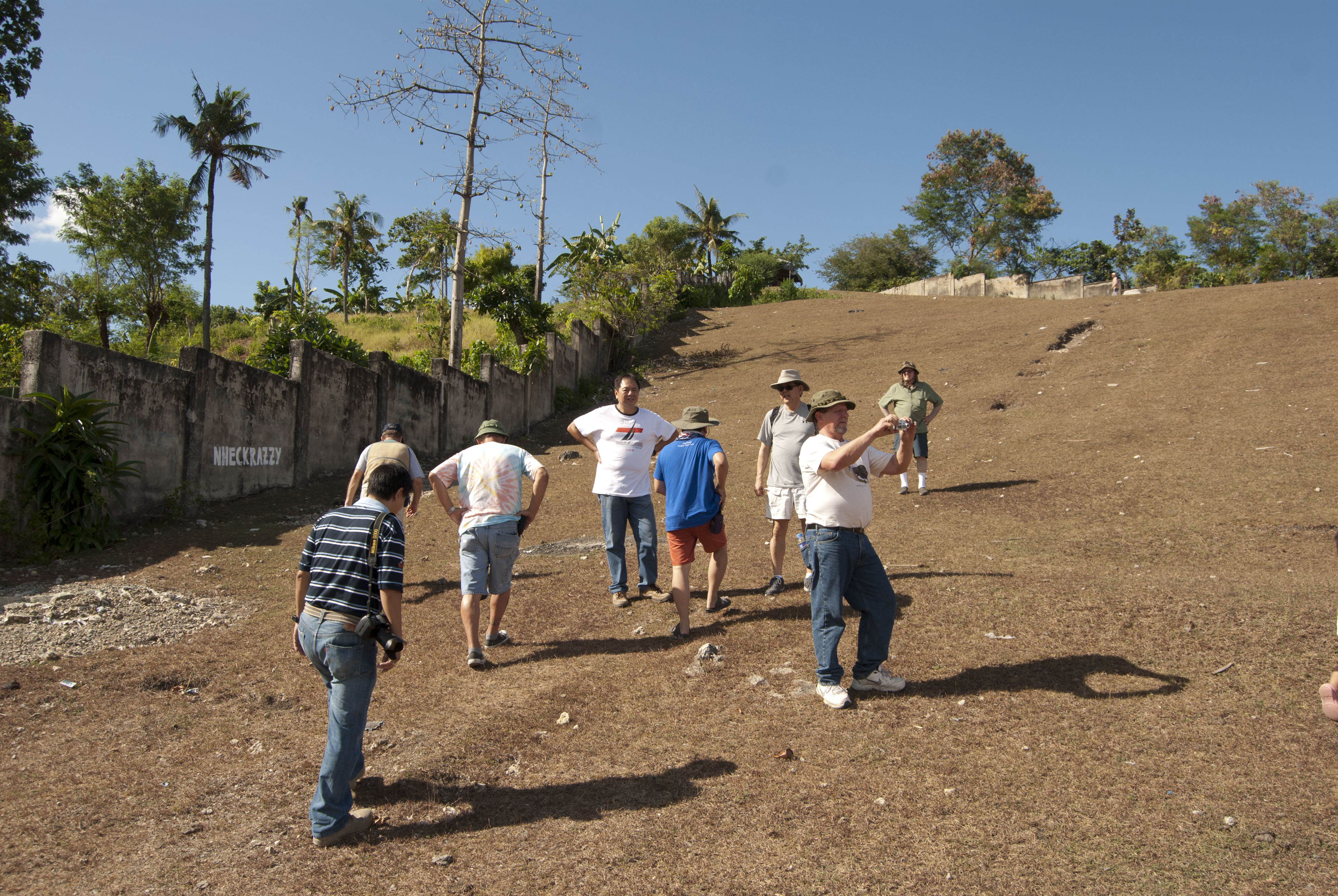
Members of the Americal Division Veterans Association, accompanied by the Go Chan family, walk the slopes of Go Chan Hill in 2015. Source: Dave Colamaria.
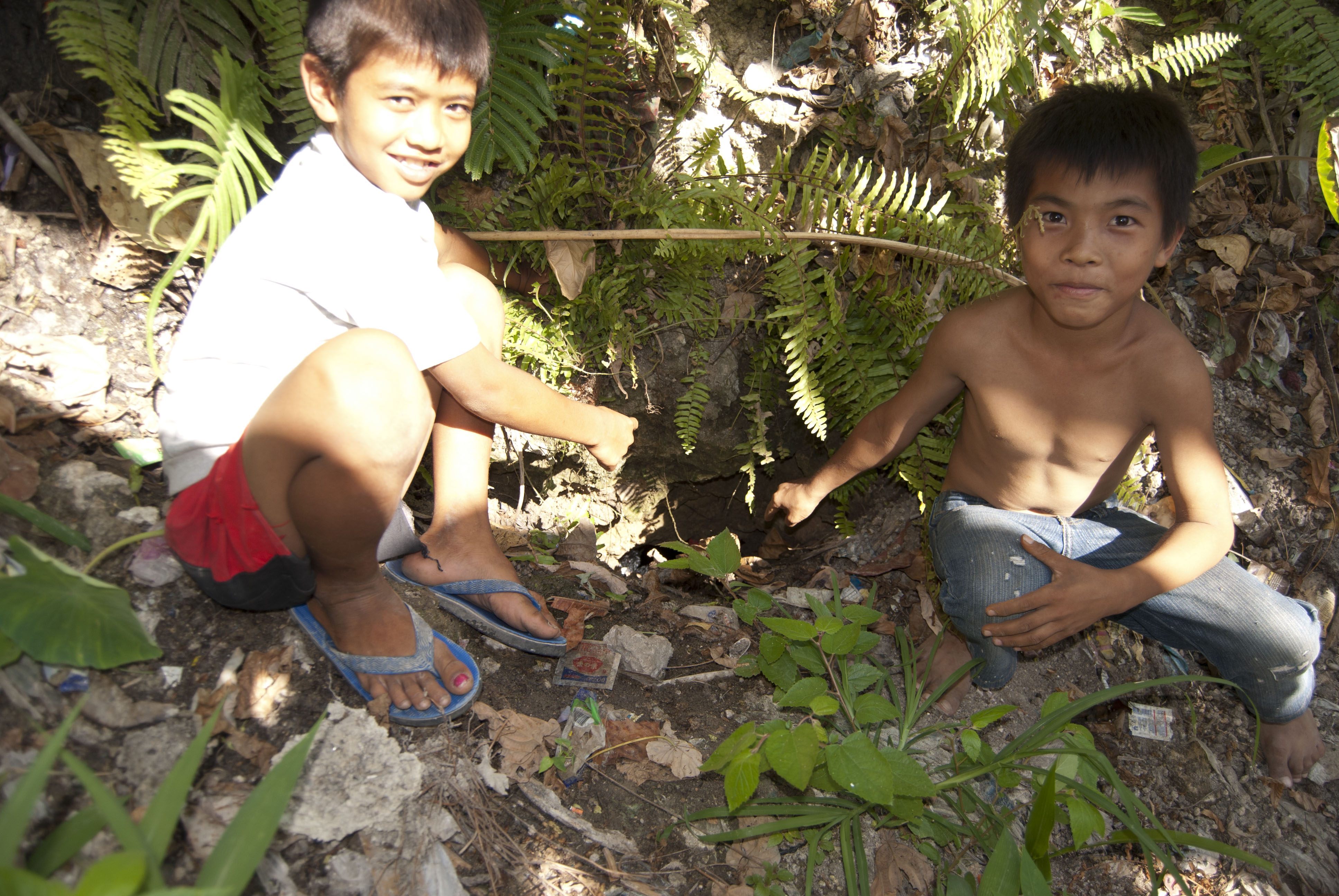
Local children point out the buried entrance to the Japanese tunnel complex under Go Chan Hill. Source: Dave Colamaria.
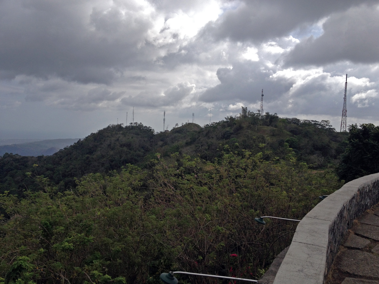
Peaks along Babag Ridge, as seen from Tops Skyline Garden in 2015. Source: Dave Colamaria.
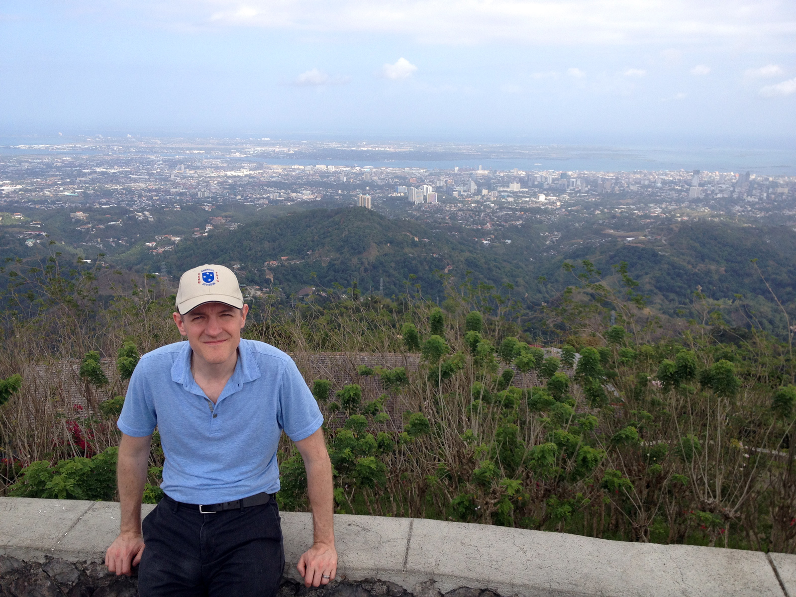
Dave Colamaria at Tops Skyline Garden on top of Babag Ridge, looking down on the sprawl of Cebu City below. Source: Dave Colamaria.
(Note: for a detailed introduction to the Americal Division Veterans Association’s 2015 trip to Cebu, along with links to other stories from the trip, read our introductory story Cebu 2015: The Ghosts of World War II, 70 Years Later. Learn more about the World War II battle for Cebu here.)
The most brutal fighting on Cebu during World War II occurred on the imposing hills that rise up just a few miles from the shoreline. The Japanese defenders essentially conceded the beach and Cebu City, choosing to hunker down in caves and fortified positions high in the hills. This was consistent with their overall strategy in the Pacific in 1945, and it led to terrible American casualties in that last year of the war. After securing the city and its airfield, Americal Division troops began to take fire from Japanese emplacements in the hills above. The first half of April 1945 was a terrible slog for the men of the Americal, as they inched their way up the hills in the face of stubborn resistance. The final battles on Babag Ridge in mid-April finally broke the Japanese defense, and caused them to flee northwards along the long, thin island.
Our group from the Americal Division Veterans Association had a chance to visit these hills in 2015. You can see in Photo #1 what those hills looked like in 1945, and in Photo #2 what they look like in 2015. On the afternoon of our first day of touring, our van wound its way up narrow mountain roads, with small shacks and shanties cobbled together to the very edges of the drivable surface. At times, we wondered if we would even fit past vehicles coming in the opposite direction. The hills were covered with heavy tree growth on all sides. In 1945, this was not the case, the terrain was more open. After the war, trees were brought in from abroad as part of a reforestation program.
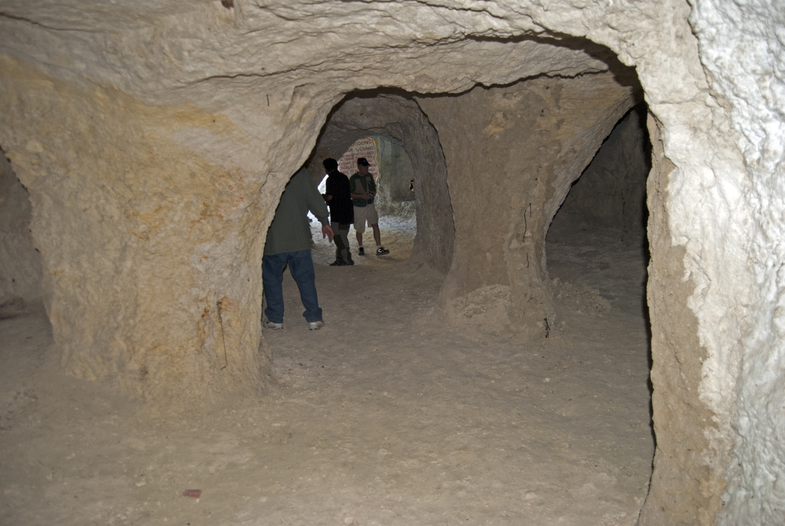
We first visited the reservoir at Buhisan Dam, which was captured on the second day of the invasion by two companies of the 182nd (not Company G) in conjunction with Filipino guerrillas. After a short drive, we took a quick hike to the location of two Japanese tunnels, carved out of the side of mountain faces (Photo #3 shows tunnels in 1945, Photo #4 shows what they look like in 2015). It was eerie inside the tunnels, particularly when looking out of the firing hole, with a clear view down the road that American troops would used for their advance. This was also our first opportunity to meet the local Cebu media, who followed us around for a bit. You can read one of their stories here. You’ll note that we had some communications issues, as the reporter mistakenly believed that I am a Vietnam veteran. But it made me feel good to get my grandfather Ed Monahan‘s name in the local papers 70 years after he arrived on the island under fire. Another story here features a nice photo of two of our fellow travelers in one of the caves.
On our second day of touring, we visited a significant battle site called Go Chan Hill – and uncovered the story behind its name. Rising up in the foothills at the base of Babag Ridge, Go Chan Hill is a small rise that had a lighthouse tower on it at the time of the war. On 29 March 1945, Company A of the 182nd Infantry was advancing up the hill, when a massive explosion shook the entire area. When the smoke cleared, the company had been virtually annihilated. Already understrength due to the fighting in the previous months on Leyte, the killed and wounded from this explosion rendered Company A unfit for battle, and it was withdrawn. There is some disagreement as to the source of the explosion. The men of the Americal were convinced that the Japanese defenders had set a timed explosion to ignite bombs and ammo dumps in the caves under the hill. Some believe that an American tank fired a round into a cave opening and accidentally ignited an ammo dump.
70 years later, we set out to visit this hill, on the outskirts of the built-up urban center. I was surprised to find that the hill took its name from the family that owned it: the Gochans. Members of the family still live near the hill, in a beautiful complex overlooking the hill itself. The family was gracious enough to invite us over for food and drink, and they shared their family memories with us. It was truly a thrill to meet Mrs. Gochan, who was just a small child during the war. I had the chance to speak with her for a few minutes, and I enjoyed every minute of it. The Gochans also arranged for us to tour the hill, which at this time is mostly free of development. We walked up the steep slopes of the hill itself (Photo #5), and then took a short hike through some woods to see buried openings that lead to the Japanese tunnel complex (Photo #6). We also met up with their cousin Harley for a group outing later in the week. It was a real pleasure to meet this family, and explore their connections to World War II.
Buhisan Dam and Go Chan Hill served as a good introduction to the steep hills of Cebu, but looming above was the rugged range of Babag Ridge. The steep ridge line soars 2,000 feet above sea level, just a few miles from the beach. All of us in the group were surprised at how intimidating these hills were. We’d read about them in history books, but seeing them in person really brought home how difficult it must have been for the soldiers of the Americal to wrest them from the Japanese. We had several chances to visit the ridge during our trip. On our first day of touring, we had dinner at beautiful Chateau de Busay, an elegant restaurant and lodge built just a few hundred feet below the top of the ridge. Knowing full well that the battles along the ridge were the toughest of the Cebu campaign, I had contemplated what it would be like to stand on those hills. Unfortunately, during that first visit to the hill, I did not have a chance for quiet reflection. There were two weddings going on simultaneously on the grounds of the chateau, and their music echoed through the air around us. We did have one rather surreal moment at the Chateau. After dinner, we lounged about, discussing the guerrillas on Cebu with several knowledgeable locals. The quiet night air was broken by a serious of loud cracks. We realized that one of the wedding parties was celebrating with fireworks. The rattle and explosion of the fireworks continued for several minutes, and for a brief moment I imaged what it must have been like during the night battles along the ridge during the war.
One downside to our first trip to Babag Ridge is that we did not make it to the top of the ridge. From what we understand, there may be Japanese fortifications still in place on the hill, but they are not easily accessible. I felt a bit of remorse throughout the week that we had not made it to the top, but on the last day of the trip, following the dedication of the surrender monument, I found myself with a few extra hours before my flight was scheduled to depart for Manila. I’d been hearing about a place called “Tops,” a scenic spot at the top of the ridge. We consulted with the hotel concierge, and he said it was a short drive, so Sam Arnold and I secured a cab and headed up. I was a bit nervous, with my flight scheduled for that evening, but the trip proved well worth it. Tops Skyline Garden is the best view of Cebu City and the coastline that you can get. It is a stunning panorama, with a commanding view for 180 degrees. I don’t know if this hilltop is the one that the men of Company G assaulted on 12-13 April 1945 in a daring night time bayonet raid. It might have been, or maybe it was one of the nearby hill tops (see Photo #7). At this time I can’t say. But what I can say is that my last few hours on the island were well spent in that short side trip to Tops (see Photo #8).